Regional Ring Road: Second Regional Gazette release allows a 21-day objection period
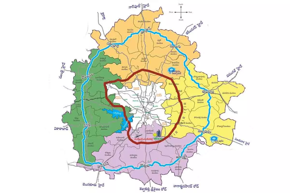
The second gazette of the northern part of the Regional Ring Road (RRR) has been issued. This Gazette No. 3, released by the Union Ministry of National Highways on Thursday,
The second gazette of the northern part of the Regional Ring Road (RRR) has been issued. This Gazette No. 3, released by the Union Ministry of National Highways on Thursday, lists the survey numbers of villages under the jurisdiction of three (out of eight) officers in the Competent Authority erected by the government (land acquisition).
The survey numbers of 31 villages and the land to be acquired that's under the jurisdiction of the Additional Collector of Yadadri-Bhuvanagiri District and RDOs of Andol-Jogipeta from Sangareddy District. This gazette features clear and specified details of survey numbers for the assigned 617 hectares of land to be acquired. As per the Gazette, while Additional Collector of Yadadri-Bhuvanagiri is assumed to acquire land of about 208.6090 hectares in Gandhamalla, Virareddypalle, Konapur, Ibrahimpur, Dattayapalle, Velupupalle, Mallapur and Dattarpalle villages as being part of the Competent Authority; 108.9491 hectares of land would be acquired by RDO of Sangareddy District's Andol-Jogipeta covering Shivampeta, Vendikol, Venkatakishtapur (Angadi), Lingampally and Korpol villages.
The acquired land throughout this act is reassigned to Chinnakondur, Varkatpalle, Gokaram, Poddatur, Valigonda, Sangam, Choutuppal, Lingojigudem, Pantani, Pahilvanpur, Kanchenpalle, Tekulasomaram, Redlarapaka, Nelapatla, Thallasingaram, 300 villages under RDO.
The people residing in the areas under the jurisdiction of mentioned three officers were given a chance to confront their objections in 21 days (from the date of publication of the gazette). After the objections were dealt with, updates were released. The 3D Gazette will be released in a month, detailing how much land will be acquired in a survey number and who owns it.


