Hyderabad: Geospatial tech can boost agri yield, says Tessy Thomas
Rajendranagar: With a view to exploring the possibilities of enhancing farm productivity using existing natural resources with the help of the state-of-the-art technologies in the agrarian field, a national conference on Geospatial Technologies in Agriculture began at ICAR-NAARM, Rajendranagar, on Thursday.
The two-day programme is being jointly organised by the Association for Management of Agricultural Research and Agripreneurship (AMARA), Hyderabad and ICAR-NAARM.
Addressing the conference, Director General (Aeronautical Systems), DRDO, Dr Tessy Thomas, the first woman scientist to head a missile project in India, said that technology has three major players such as the scientists, the farmers and the policy makers. Every impossible could be made possible if all the three players come together.
Asserting that India is one of the finest countries today in the area of remote sensing, she said "technological innovations and geospatial technology have helped the country in creating a dynamic and competitive position in the field of agriculture which is capable of providing excellent nutrition to the people."
Global Positioning System (GPS) and Geographical Information System (GIS) can help in effective crop yield estimate, soil held analysis and erosion identification etcetera. "GIS tools help farmers to conduct forecasting and manage the agricultural production by utilising multispectral imagery collected by the satellites and tell us which crop should be planted where and how to maintain the soil nutrition so that plants grow better," she explained.
Stressing the need for common working groups with specialists from space and agriculture technology to achieve common goal of increasing the agriculture production, Dr Ch Srinivasa Rao, Director, NAARM and president of AMARA, said "by applying the various GIS tools in the field of agriculture both agriculture and space technology should go hand in hand."
Dr S K Soam, the Joint Director of NAARM & Vice-President of AMARA, said, "As we are discussing about GIS it made us feel proud having a chief guest like Dr Tessy Thomas and the initiative we have stirred Nari-Shakti. The batch has 56 female professionals out of 135 overall members. This made the program a blend of Nari-Shakti (Women Power) and Shakti (Power of Defence)." he explained.
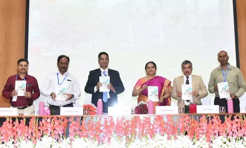
During the inaugural programme two publications –Book of Abstracts and Practical manual for GIS – were released by the chief guest. Earlier Dr D Thammi Raju, General Secretary, AMARA narrated the genesis of Association for Management of Agricultural Research and Agripreneurship (AMARA), a nascent organization, with a vision to provide an integrated and inclusive platform supporting knowledge driven agricultural development in bringing prosperity through nurturing innovation and entrepreneurship in agriculture. The conference is expected to bring key recommendations related to crop estimation, yield modelling, precision farming, remote sensing, agriculture GIS, cloud computing, wireless and mobile GIS for agricultural field work besides the application of GIS techniques in decision making. The conference is organised by Dr P D Sreekanth and Dr M Balakrishanan, Principal Scientists of the Academy.
An ongoing national conference on farm productivity with help of geospatial technologies at NAARM is expected to bring key recommendations related to crop estimation, yield modelling, precision farming, remote sensing, agriculture GIS, cloud computing, wireless and mobile GIS for agricultural field work besides the application of GIS techniques in decision making

