Welcome the floods

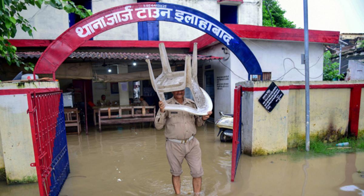
Mumbai and Delhi have been victims of floods that are of our own making We have made vertical walls on the banks of the Sabarmati River in Ahmedabad, Mithi in Mumbai and Gomti in Lucknow This has freed a large part of the riverbed for property development That is fine as long as there are no floods in the river
Mumbai and Delhi have been victims of floods that are of our own making. We have made vertical walls on the banks of the Sabarmati River in Ahmedabad, Mithi in Mumbai and Gomti in Lucknow. This has freed a large part of the riverbed for property development. That is fine as long as there are no floods in the river.
The river flows peacefully within the retaining walls. But the situation turns dramatically when there are floods. The flood waters spread through large urban areas once they flow above the retaining walls. That is not how it used to be. The riverbanks had a slope earlier somewhat like a “V” shape. The area available for the flood waters to flow increased as the water level increased.
Making retaining walls have changed the shape of the riverbanks like a “U.” The area available for the flood waters to escape no longer increases as the water level rises. Consequently, the river water flows above the retaining walls much sooner than before. No wonder Mumbai faced more floods this year even when the rainfall was not exceptional. We have invited floods in cities across the country by adopting the Sabarmati model of river development.
We have built dams like Tehri so that flood waters can be captured and retained in the reservoir. The flow of the river in the plains is less due this. And, indeed, there have been lesser floods in the plains. That is only the immediate benefit of these dams, however. The same dam has led to intensification of the floods in the plains in the long run. The river continually brings sediments from the hills.
These are deposited in the riverbed. This leads to a gradual rise in the level of the river bed. The capacity of the river to carry water to the sea is gradually reduced. Then comes once-in-five-year massive flood. The sediments deposited during the previous five years are flushed out and thrown into the sea. The riverbed is cleaned, its depth is again increased, and her capacity to carry the rain water to the sea is restored.
This is somewhat like the cleaning we do in our homes before every Diwali festival. The dirt deposited during the year is removed. Or it is like the cleaning of the street morning after the weekly market. The dirt deposited during the week is removed.
Dams like Tehri have captured the river water and prevented these massive floods. Thus, the Tehri Hydro Power Corporation gloats that the floods of 2013 in Uttarakhand would have been worse if Tehri Dam was not there. Correct. But the end of the massive floods also means that the sediments deposited in the river bed is no longer flushed to the sea. The riverbed is rising continually.
The capacity of the river to carry the rain water to the sea is reducing regularly and not being restored periodically as it was being done previously. Consequently, even ordinary rains are now taking the form of floods. In our anxiety to “control” floods by making dams, we have actually made them worse.
Embankments have been made by the Government along the rivers in UP and Bihar for flood control. This has truly reduced the flood fury in normal years. The water is contained between the embankments and life remains unaffected outside them. However, the sediments brought by the rivers gets deposited between these embankments. Soon, the level of the riverbed rises due to this deposition.
Then the height of the embankment is raised to continue containing the river between the embankments. The level of the riverbed rises above the level of the surrounding plains after a few times of such raising of the embankments. Then the river flows above the ground level like the metro train. It is not possible, however, to keep raising the level of the embankments perpetually.
As a result, sooner or later the embankments break. That leaves no path for the rain waters and flood waters to escape because the channel of the river is now filled up with sediments. This leads to much worse floods. We made dams and embankments to control the floods, but we have done exactly the opposite.
The reduction in floods due to dams and embankments has another negative consequence. In normal course the flood waters spread over a large area. They flow like a thin sheet on the land. This inundation of the land leads to recharge of ground water. I had an occasion to study the floods in the Rapti River near Gorakhpur in 1998. Village people told me that previously flood used to come every year.
The flood waters spread and recharged the ground water. It was possible to extract water from merely five feet depth throughout the year. The farmers used to sow special varieties of paddy that grew in height as the level of the flood waters increased.
Villages were settled on mounds that remained safe even though the road connection with the cities was broken. The reduction in floods has led to less recharge of ground water and its level has receded. The increase in area under irrigation due to Tehri Dam has been undone by the reduction in are under irrigation due to less recharge of the ground water.
The present day floods are becoming worse because of our own folly. We must immediately take the following steps. One, we must dismantle the retaining walls made on the urban river banks. We must acquire more land near the river and give it to the river just as we offer sweets in the temples. We must restore the “V” shape of the riverbanks.
Instead of making profit by selling property along the rivers, we must make profit by making tourist spots along the river as made on the banks of the Thames River in London. Two, we must remove storage dams like Tehri, Bhakra and Sardar Sarovar. We can increase the irrigated area more by making check dams and recharge wells in the plains.
The rainfall in the plains is about three times the rainfall in the hills. Removal of the dams will restore the massive floods, flush the sediments to the sea and actually lead to a reduction in the flood fury.
Three, we must remove all embankments along the rivers. We must learn to live with the floods. We must establish the villages on mounds so that life and property is not damaged during the floods and we can allow Mother Nature to recharge the ground water and provide sustaining life to our people. Author was formerly Professor of Economics at IIM Bengaluru


