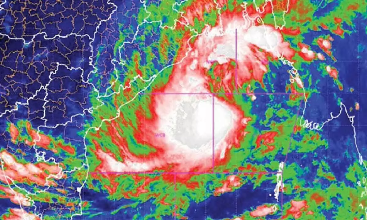
Cyclone likely to make landfall between Bhitarkanika & Dhamra

Massive evacuation plan to relocate 10 lakh people in 14 districts
Bhubaneswar: As cyclone ‘Dana’ barrels toward the Odisha coast, threatening to impact nearly half the State’s population, the government is racing against time to execute a massive evacuation plan aimed at relocating around 10 lakh people in 14 districts to safety.
The IMD on Wednesday said the cyclone is likely to make landfall between Bhitarkanika National Park and Dhamra port, located around 70 km away from each other, early on Friday. It said the landfall process will start from the night of October 24 and will continue till the morning of October 25. The maximum speed during the landfall process is likely to be around 120 kmph, IMD DG Mrutyunjay Mohapatra said. He said landfall is mostly a slow process which usually takes around 5-6 hours. “Therefore, heavy rainfall, wind and storm surge will reach the peak during the landfall time which is between October 24 night and October 25 morning,” he added.
According to the latest IMD bulletin, the cyclone moved northwestwards with a speed of 13 kmph and lay centred about 490 km southeast of Paradip (Odisha), 520 km south-southeast of Dhamra (Odisha) and 570 km southsoutheast of Sagar Island (West Bengal). During the landfall, a tidal surge of up to 2 metres is expected, with the cyclone reaching the coast at a wind velocity of 120 kmph, Umashankar Das, senior scientist at the regional meteorological centre in Bhubaneswar, said. Das warned that low-lying areas in Kendrapara, Bhadrak and Balasore districts are likely to be inundated and recommended that the government evacuate residents from these regions.
To facilitate this, 288 rescue teams from National Disaster Response Force (NDRF), Odisha Disaster Rapid Action Force (ODRAF) and Fire Services have been deployed, with additional personnel requested from the NDRF.
The government has identified 14 districts at risk, with the coastal areas facing high winds and inland regions expected to receive heavy to extremely heavy rainfall. The districts are Angul, Puri, Nayagarh, Khurda, Cuttack, Jagatsinghpur, Kendrapara, Jajpur, Bhadrak, Balasore, Keonjhar, Dhenkanal, Ganjam and Mayurbhanj.
“The State has identified over 3,000 vulnerable locations (villages) across 14 districts, primarily along the coastal belt, and started evacuation procedures. Approximately 10,60,336 people are likely to be evacuated before cyclone Dana makes landfall,” State Revenue and Disaster Management Minister Suresh Pujari said.
In addition to the evacuation, the State has set up around 6,000 relief camps where evacuees will have access to cooked meals, milk for children, medical care, safe drinking water, and security for women.
The IMD cautioned that cyclone ‘Dana’ would bring significant rainfall to the State, predicting light to moderate rain at most locations, with heavy rainfall (7-11 cm) in isolated areas over Balasore, Bhadrak, Kendrapara, Jagatsinghpur, Puri and Khurda starting in the evening of October 23.
On October 24 and 25, heavy to very heavy rainfall is expected in several places, with isolated areas receiving extremely heavy rainfall (over 21 cm) in districts including Balasore, Mayurbhanj and Jajpur, it added.
The IMD has prohibited all marine activities, including fishing, in the Bay of Bengal until the cyclone has passed. “All fishermen returned to the coast by Tuesday evening,” said Pujari..
Meanwhile, parts of Kendrapara and Bhadrak districts in Odisha experienced rain and adverse weather conditions on Wednesday afternoon with the Indian Meteorological Centre (IMD) saying that the outer bands of cyclone Dana has begun to affect the eastern coastline.


